
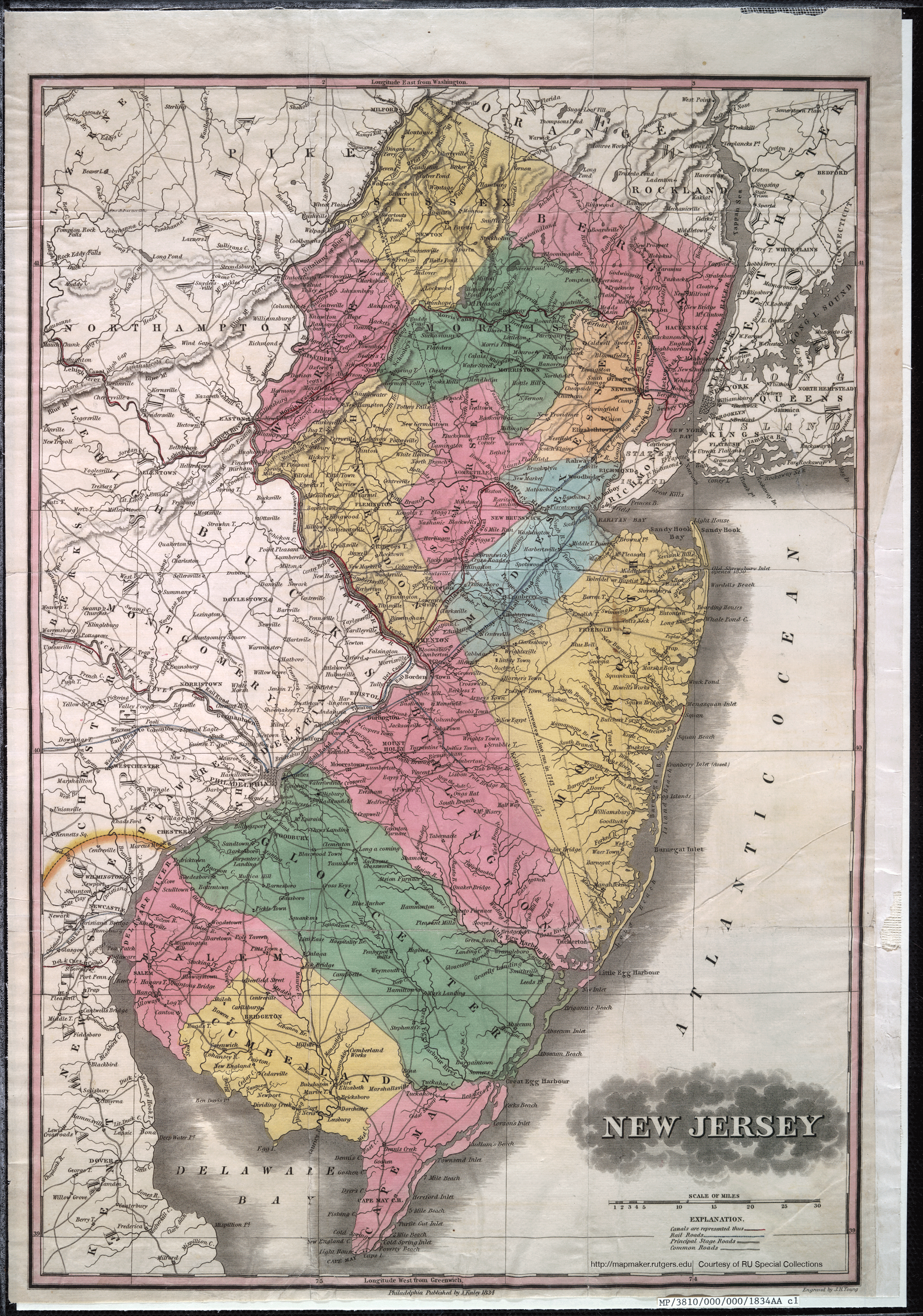
Above is the pertinent detail from an historic New Jersey state map available at Rutgers University's Mapmaker website, while below are several related entries from the Gazetteer of the State of New Jersey, by Thomas F. Gordon. Both items were originally published in 1834. The Gazetteer, reprinted in 1973, is available at the Matawan Aberdeen Public Library at NJ 974.903 Go. It is also available in a scanned version (with some OCR errors) at Internet Archive.
Middletown t-ship, Monmouth co., bounded N. by Raritan bay and Sandy Hook, E. by the Atlantic ocean, S. by Shrewsbury t-ship, and W. by South Amboy t-ship, Middlesex co. Centrally distant N.E. from Freehold 10 miles; greatest length E. and W. 16, breadth N. and S. 10 miles; area, 50, 000 acres; surface, on the east and centre, hilly, elsewhere, level; soil, loam, sand, and clay, not naturally of the first quality, but highly improved, in places, by the use of marl, which has become common. Sandy Hook bay runs south into the t-ship from the Raritan, and is bounded on the S. W. by the promontory of the highlands of Nevisink, and on the E. by the sand beach, forming Sandy Hook, running 6 miles north from Shrewsbury Inlet; upon the north point of which stands Sandy Hook Light-house. The t-ship is drained on the S. E., S. and S. W. by Swimming and Nevisink rivers; on the N. W. by Middletown creek ; N. by Waycake, and N. E. by Watson's and Shoal Harbour creeks. Middletown, Middletown Point, Baptisttown, or Holmdel and Mount Pleasant are villages, the two first post-towns, of the t-ship. Population in 1830, 5128. In 1832 the t-ship contained about 1000 taxables, 277 householders, whose ratables did not exceed $30; 169 single men, 27 stores, 5 saw mills, 13 run of stones for grinding grain, 1 fulling mill, 36 tan vats, 11 distilleries, 956 horses and mules, and 2286 neat cattle, above 3 years of age; and paid state and county taxes, $2620 20. Good lands will bring in this t-ship an average price of $60 the acre.
In 1682 Middletown contained about 100 families; several thousand acres had been collected for the town, and many thousand for out-plantations. John Browne, Richard Hartshorne, and Nicholas Davis, had well improved settlements here; and a court of sessions was holden twice or thrice a year, for Middletown, Piscataway and their jurisdictions.
Middletown, post-town of Middletown t-ship, Monmouth co., 13 miles N. E. from Freehold, 56 from Trenton, and 221 from W. C, situate in a rolling and fertile country, based on marl; contains an Episcopal, a Dutch Reformed, and a Baptist church, 2 stores, 2 taverns, and from 20 to 25 dwellings, among which, there are several very neat and commodious.
Middletown Point, port of delivery of Perth Amboy district, and post-town of Middletown t-ship, Monmouth co., upon Middletown creek, about 3 miles from the Raritan bay, 11 miles N. of Freehold, 47 N. E. from Trenton, and 213 from W. C; lies on a bank elevated about 50 feet above the stream, fronting a marsh on the opposite side; contains a Presbyterian church, from 75 to 100 dwellings, many of which are very good buildings, 8 or 10 stores, 4 taverns, and a grist mill. This is the market of an extensive country, and large quantities of pork, rye, corn, cord wood, and garden truck, are thence sent to New York. The soil immediately around the town is sandy. There is a bank here, incorporated in 1830, with a capital of $50,000, of which $10,000 only were paid in, in 1833.
0 comments:
Post a Comment